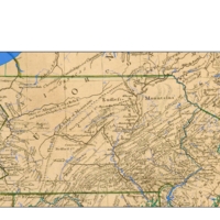
Pensilvania: General map of the Middle British Colony
Dublin Core
Title
Pensilvania: General map of the Middle British Colony
Description
This map only includes the PA portion; Complete descrption from the website: A GENERAL MAP OF THE MIDDLE BRITISH COLONIES, IN AMERICA; VIZ. VIRGINIA, MARILAND, DELAWARE, PENSILVANIA, NEW-JERSEY, NEW-YORK, CONNECTICUT, AND RHODE ISLAND: OF AQUANISHUONIGY, THE COUNTRY OF THE CONFEDERATE INDIANS; COMPREHENDING AQUANISHUONIGY PROPER, THEIR PLACE OF RESIDENCE, OHIO AND TIIUXSOXRUNTIE THEIR DEER-HUNTING COUNTRIES, COUXSAXRAGE AND SKANIADARADE, THEIR BEAVER-HUNTING COUNTRIES; OF THE LAKES ERIE, ONTARIO AND CHAMPLAIN, AND OF PART OF NEW-FRANCE WHEREIN IS ALSO SHEWN THE ANTIENT AND PRESENT SEATS OF THE INDIAN NATIONS. By Lewis Evans 1755. Engraved by Jas. Turner in Philadelphia. Published according to Act of Parliament, by Lewis Evans, June 23, 1755. and sold by R. Dodsley, in Pall-Mall, London & by the Author in Philadelphia. The full title of this famous map is given here because it is the first map to treat the Indian nations as co-equal with the colonies; by comparison note the title of the Mitchell map below. Incidently, it also lists Delaware as a colony separate from Pennsylvania; something the Penns may not have liked. The map was accompanied by a pamphlet titled Geographical, Historical, Political, Philosophical and Mechanical Essays. The First Containing an Analysis of a General Map of the Middle British Colonies in America. This famous map has been discussed in many map histories and there were many subsequent copies not all listed here; see Klinefelter, Gipson, McCorkle #755.15, 756.4, 758.3, 760.3, 771.3,775.5, 776.10, Sellers & van Ee #709-716, Wheat & Brun #298-99. A discussion of various states and copies of Evans' map is also given by Stevens and Tree in Tooley, Chapter 2. The plate was modified often by a succession of publishers such as Thomas Jefferys, Sayer & Jefferys, Sayer & Bennett, Laurie & Whittle. This image is from the Library of Congress where the map can be examined in detail.
Creator
Lewis Evans
Date
1755
Identifier
Bf04z009
Files
Collection
Citation
Lewis Evans, “Pensilvania: General map of the Middle British Colony,” Stories of the Susquehanna Valley, accessed April 20, 2024, http://ssv.omeka.bucknell.edu/omeka/items/show/220.
